Footpaths in the Little
Ouse headwaters
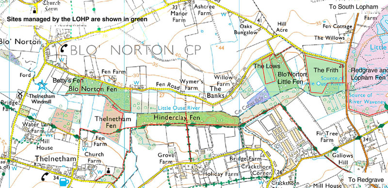 Basemap image produced from the Ordnance Survey Get-a-map service. Image reproduced with kind permission of Ordnance Survey and Ordnance Survey of Northern Ireland.
 The Little Ouse Headwaters Project has an open access policy and welcomes visitors to the sites that it manages (shown in purple). Paths are provided to ensure easy and safe access and to minimise damage to sensitive wildlife. For more detailed access information, see the individual site accounts.
Red lines show all of the paths open to the public within the Little Ouse headwaters area.
Red lines alone indicate permissive paths. These are almost always open but discretionary closures are possible.
Red lines superimposed on green broken lines show public footpaths.
Red lines superimposed on a green broken line with green diamonds mark the Angles Way long-distance path.
The minor roads in the area (yellow) are all designated 'Quiet Lanes'.
Areas shaded pink are nature reserves managed by the Suffolk Wildlife Trust: LOHP sites are shaded green.