Where are the Little Ouse Fens?
Basemap image produced from the Ordnance Survey Get-a-map service. Image reproduced with kind permission of Ordnance Survey and Ordnance Survey of Northern Ireland.

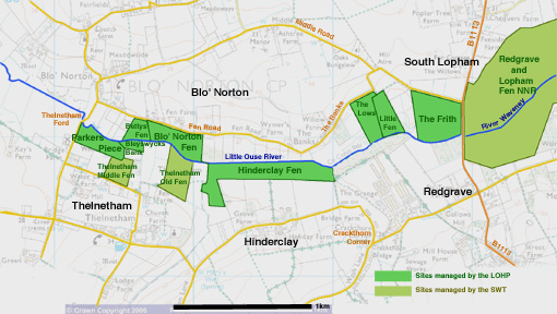
Click on the map above for further details of the individual sites within the project area.

Those marked in bright green are managed by the Little Ouse Headwaters Project. Those marked in yellow-green are managed by the Suffolk Wildlife Trust.


Back to Home page
The Frith (LOHP) Little Fen County Wildlife Site (LOHP) County Wildlife Site (private owner) Hinderclay Fen former SSSI (LOHP) Thelnetham Fen SSSI, SAC (Suffolk Wildlife Trust) Blo' Norton Fen SSSI, SAC (LOHP) Bettys' Fen SSSI, SAC (LOHP) The Lows County Wildlife site (LOHP)